This story originally appeared in our sister publication Elevation DC.
As a new wave of people flood cities to live, work and play, many arrive on four wheels, creating massive headaches for city planners and drivers alike.
Smart cities are looking at ways to reduce parking issues, which cause street congestion and wasted time for drivers searching for spaces. Off-street parking isn't a solution: it is costly to build and takes up space that could be used for other, more dynamic uses.
While some municipalities are looking into solutions such as parking prices that fluctuate based on demand, others are revamping parking permit policies and updating zoning laws to allow for transit-oriented development.
Cities that don't move fast enough may soon be left in park.
Here's a look at three of cities in the Issue Media Group network that are tackling the car problem in innovative ways.
D.C. navigates curbside demand
This summer in Washington, D.C, if you're going to the Verizon Center for a Wizards game on a Friday night, there's a chance you'll pay a little more to get a curbside parking space steps away from the venue. If you're willing to walk a little farther, you can pay a cheaper rate.
This is part of the
ParkDC pilot program, which will address issues of traffic congestion in the city's Chinatown/Penn Quarter area.
"Cruising around the block to find an open parking space can contribute to as much as twenty-five percent of the congestion," says Soumya S. Dey, director of research and technology transfer at the District Department of Transportation (DDOT). "So there is recognition now that if you manage your curb space more efficiently, then you'll manage your street congestion more efficiently."
One of the busiest parts of town, the adjacent Chinatown and Penn Quarter corridors are frequented by sports fans, foodies, retail junkies and theater-goers. ParkDC's plan will adjust prices of 1,300 parking meters through a demand-based strategy that will consider location, time of day and other factors that dictate how busy an area is at any given time. In other words, the more people who want to park on a given block, the more expensive it will be.
In researching solutions to parking problems across the country, D.C. turned to Seattle's performance-based parking program. Launched in 2011, Seattle's Department of Transportation varied metered parking rates from $1 per hour to $4 per hour in twenty-three areas throughout the city. After an evaluation period, the city saw outcomes that reflected one of its main goals: to always have at least two parking spaces available per block.
In 2012, Los Angeles launched a similar program to reduce traffic congestion, lower air pollution and make commuting more efficient.
LA Express Park covers 6,000 metered parking spots and 7,500 city-owned lot spaces. While prices range from $1 to $6 per hour, the average is $1.76 per hour, which is lower than the $1.95 per hour the city charged before the program launched. With its success, the program is expanding to Westwood Village, with plans to reach Hollywood in 2015, according to the Los Angeles Department of Transportation.
Perhaps demand-based pricing will lead to D.C.'s removal from
NerdWallet's Top Ten Worst Cities for Parking your Car, which based rankings on high parking prices and theft rates.
Over the past few months, there's been a significant push to get the word out about the new program. An interactive app, currently under development, will help drivers search for and then estimate just how much they will to pay for curbside parking.
"We want to give people information of where available parking spaces are," says Dey. "Once they have that information, they don't have to circle around the block to find an open space."
For the next three years, Chinatown and Penn Quarter will serve as laboratories to test this technology, with the eventual goal of expanding to other neighborhoods.
Denver's parking hits its limit
In 2014, Denver jumped from No. 16 on Forbes' annual ranking of the 20 fastest growing cities in the nation to No. 6. The Denver Regional Council of Governments projects a nearly 50 percent increase in residents, from 2.6 million in 2005 to almost 3.9 million in 2030.
While an influx of residents will be a major boost for the city's economy, it could be a nightmare for transportation officials. As development ensues, enticing more visitors to the region, there's no way to create a parking space for each new person.
"We recognized early on that we only had a limited number of parking spaces on the street," says Cindy Patton, principal transportation planner with Denver Public Works. "They can be programmed in a lot of different ways."
The agency's Strategic Parking Plan provides a citywide framework featuring five evaluators: demand, location, time, pricing and supply.
"All of those things combined can be used to create an area management plan,” explains Patton.
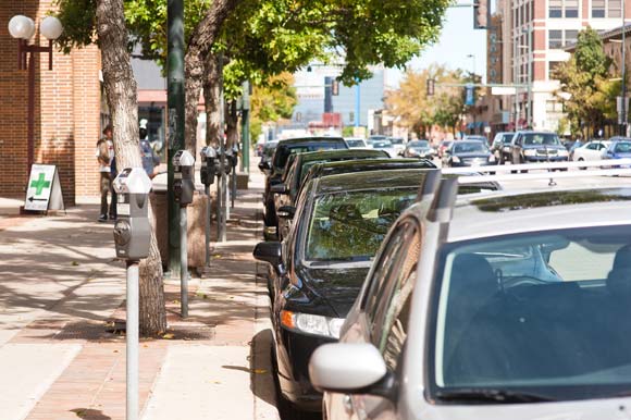 Denver's Baker neighborhood is one of the city's fastest-growing, which has led to parking headaches. Photo by Kara Pearson Gwinn.
Area management plans are hyper-local initiatives that detail strategies to address the needs of specific neighborhoods. The Baker/Broadway area for instance, has been a commercial corridor for quite some time, with landmarks like The Mayan Theatre and the Blue Bonnet Cafe, a 40-year-old Denver institution. In the past few years, the neighborhood has witnessed a resurgence with new nightspots, galleries, coffee houses and independent shops; new condos complement existing Victorian homes, bungalows and duplexes.
With all that activity, there's little consistency in parking guidelines. Hours and pricing of meters vary, but not in a strategic way.
This year, the first phase of the neighborhood's area management plan launches. All parking meter time limits will be adjusted to two hours (former conditions include a mix of one- and two-hour parking); hours of operation for parking meters will be standardized; parking meter rates will be adjusted to a consistent $1/hour; and loading zones will be strategically placed for easier maneuvering and less congestion on main roads. Lastly, short-term parking will be increased to support high-turnover businesses like coffee shops, convenience stores, etc.
In the end, planners hope to reduce tension between residents, employers and consumers battling for parking spaces.
University Circle goes multi-modal
In Cleveland, the University Circle area has long boasted essential institutions such as universities, medical centers and cultural venues. Those facilities have sustained the area, providing access to stable employment and creative opportunities.
In recent years, University Circle has emerged as an innovation district, and a slew of new retail, housing and entertainment options cater to residents and visitors alike. These developments have made parking spaces more difficult to find.
"As you can imagine, when you take a very evident piece of surface parking on a main street and build a mixed-use apartment-retail building on top of it, it can be a little confusing for people who've known about that parking spot for the last ten years," says David Razum, communications manager at University Circle, Inc., a community service organization overseeing the growth of the neighborhood. "So there has been a period of relearning for visitors, residents and workers,”
According to Razum, placing appropriate signage on the main roads has been extremely effective. There's also been a push for visitors to explore the area's website to see what parking is available that might not be directly in front of the venue. The city has also invested in transit, streetscapes, bike lanes and bike parking, making it even more attractive for employees and visitors to leave their cars at home.
Razum sees the new developments as an opportunity for residents to view the neighborhood in a new light.
"We build towards what we call a complete neighborhood, where everything you need in day-to-day life is within a twenty minutes walk," he explains. "I think it's a convenient, healthy and really gets you outside of your car and makes you interact with your neighborhood a little more."
 To alleviate parking problems, Cleveland is making it easier for people to leave their cars at home by investing in public transit and pedestrian avenue. Photo by Bob Perkoski.
The city is also upgrading its public transit. A $200 million investment in the redesign of Cleveland's Euclid Avenue integrated the bus rapid transit system, which connects the business district with University Circle. After opening in 2008, the system "helped transform the neighborhood, restoring Euclid as Cleveland's main street," says Razum.
In August 2014, a ribbon-cutting ceremony was held at the Cedar-University Rapid Station, an $18 million reconstruction project that revamped the station's formerly grim facade. And in 2016, the opening of Little Italy-University Circle Rapid Station, a $17.5 million project, should be completed.
If new transit opportunities are put to effective use, there will be less need to build parking infrastructure like lots and garages -- a route taken by the Cleveland Clinic area, just west of University Circle.
"A surface lot on a main street has a role, but I think that it can hurt a commercial or residential district because it's kind of a dead area," muses Razum. "I think that you can have surface lots and garages, but it has to be done right -- they need to blend in with the rest of the landscape and be coherent rather than separating areas with big seas of surface parking."
Parking is certainly on the radar in neighborhoods throughout Cleveland. To that end, demand-based parking strategies have been discussed at the city level for years, but so far there hasn't been much forward momentum on the issue. However, University Circle seems to be setting the stage for creative solutions by putting more options on the table.
"We will certainly continue to explore any options in the future to improve access and connectivity," enthuses Razum. "From apps, to maps, to awareness campaigns -- we are always looking to improve connectivity."
Christina Sturdivant lives in Washington, D.C. and writes about cultural, community and innovative trends in the city for Elevation DC and other local publications. Nationally, she has authored stories in HBCU Digest
and Diverse: Issues in Higher Education.
For more stories of ideas, innovations, and solutions in cities, follow @Issue_Media on Twitter.